NEWS
Traveling the Lincoln Highway in Indiana
Indiana native Carl Fisher laid out a plan to build America’s first paved transcontinental route, called the Lincoln Highway in honor of the Great Emancipator. Although it no longer officially bears Lincoln’s name, the highway remains a relevant and vital part of the communities on its path.
A Historic Road
Just over a century ago, Carl Fisher had an idea that would revolutionize transportation in the United States. Henry Ford’s affordable Model T allowed many Americans to purchase an automobile for the first time, but no network of roads existed for all those new cars. Fisher’s proposal for a transcontinental highway laid the groundwork for the National Highway System, connecting people and places coast to coast. Before the numbered road system, officials named the road the Lincoln Highway to honor the nation’s sixteenth president.
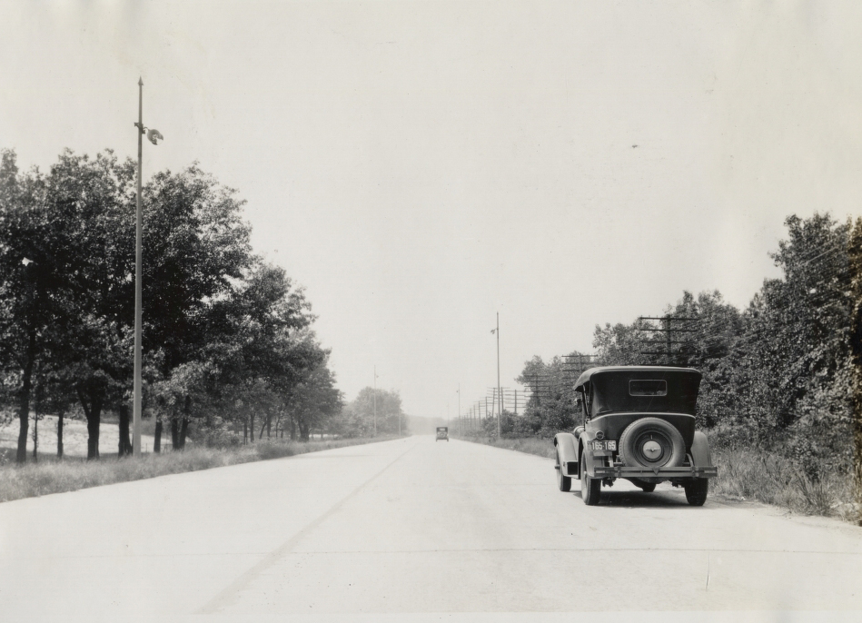
A Packard on Ideal Section of the Lincoln Highway.
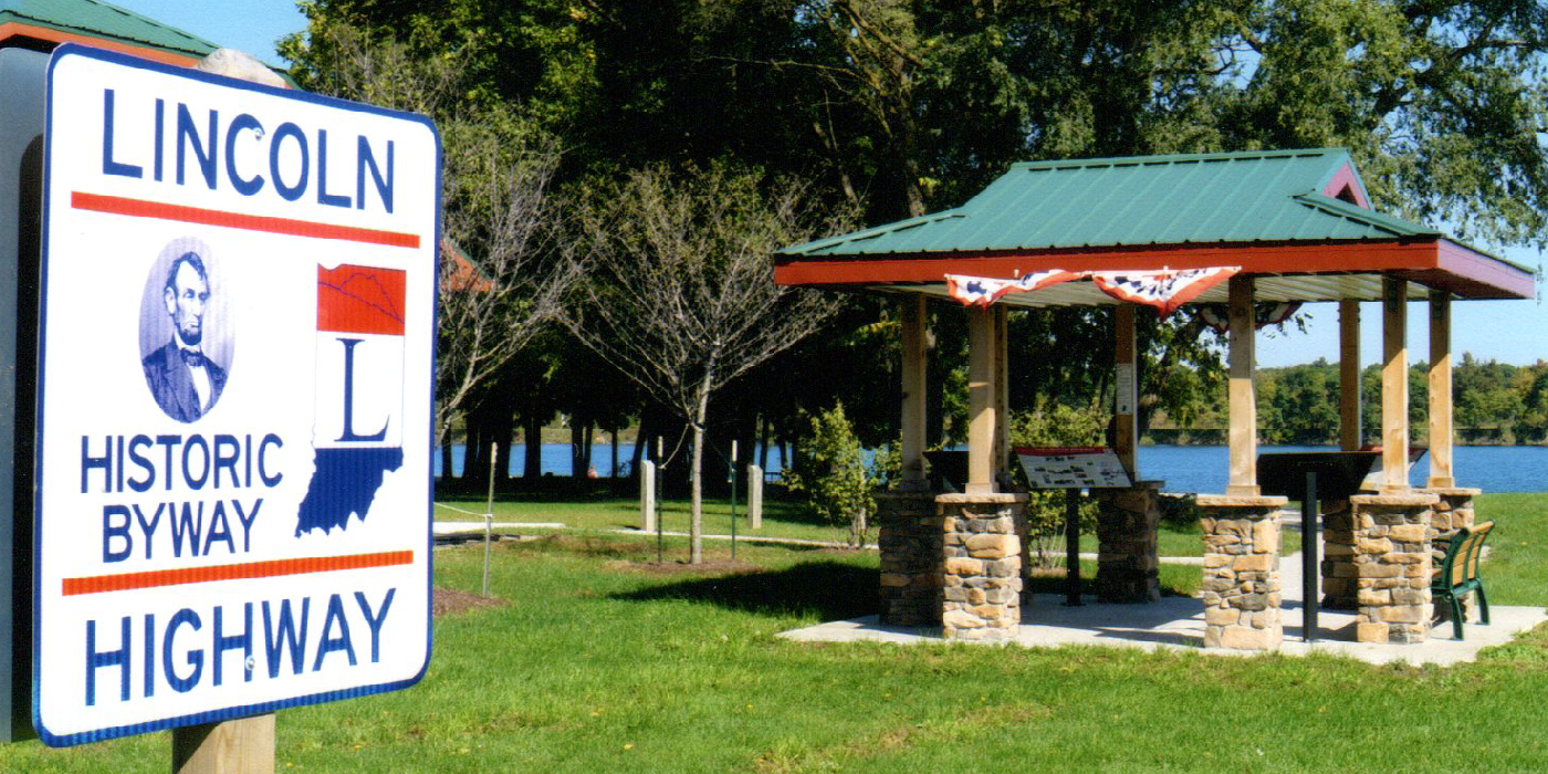
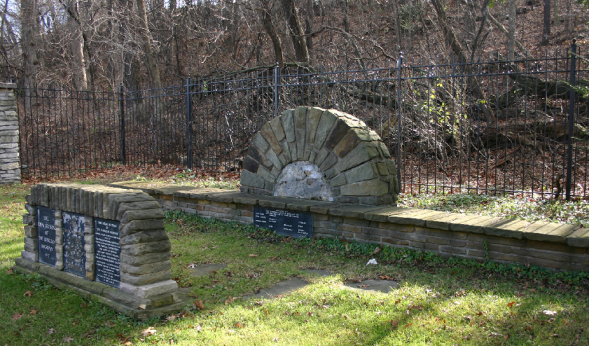
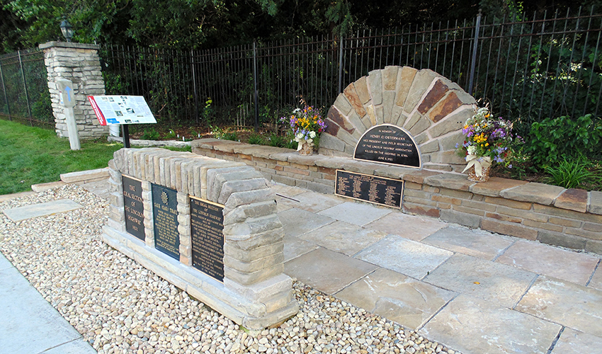
In northern Indiana, the Lincoln Highway passes through eleven counties, with two diverging routes. The Indiana Lincoln Highway Association (INLHA) aims to preserve, promote, and mark the Lincoln Highway across Indiana and educate the public about the highway’s various routes and related landmarks. In 2017, INLHA earned recognition from the national Lincoln Highway Association for efforts to promote the Indiana route, including restoration of the Henry C. Ostermann Memorial Seat and Ideal Section Monument in Dyer, and construction of a Lincoln Highway interpretive kiosk and gazebo in Goshen.
The Lincoln Highway’s Ideal Section, a documentary produced in 2018 by Paul Nelson and the Dyer Historical Society tells the story of the Ideal Section’s creation, including commentary from INLHA members and other historians. (View the full 20-minute documentary at interestingindiana.com.)
To engage twenty first-century travelers, geocacher Darel Beghtel began placing geocaches along the Lincoln Highway in LaPorte County. Now known as the Lincoln Highway Power Trail, the route includes geocaches every .10 mile from Westville to New Carlisle. Geocachers have offered positive feedback. Beghtel hopes geocachers in neighboring counties will continue the project along their portion of the road, until it traverses Indiana and beyond.
In an effort to make the Lincoln Highway story interesting, relevant, and easily accessible to children, Indiana University South Bend released an online version of the Indiana Lincoln Highway Curriculum Kit, designed for use by third and fourth grade students. To access the Lincoln Highway Story curriculum PDF and video, type Lincoln Highway in the search box at https://scholarworks.iu.edu/dspace/handle/2022/16728.
Stay up to date on the latest news, stories, and events from Indiana Landmarks, around the state or in your area.